
| ||||||||
|---|---|---|---|---|---|---|---|---|
| ||||||||
| Manitowoc-1.jpg (below, 1221 x 940, 1-man1) | ||||||||
|
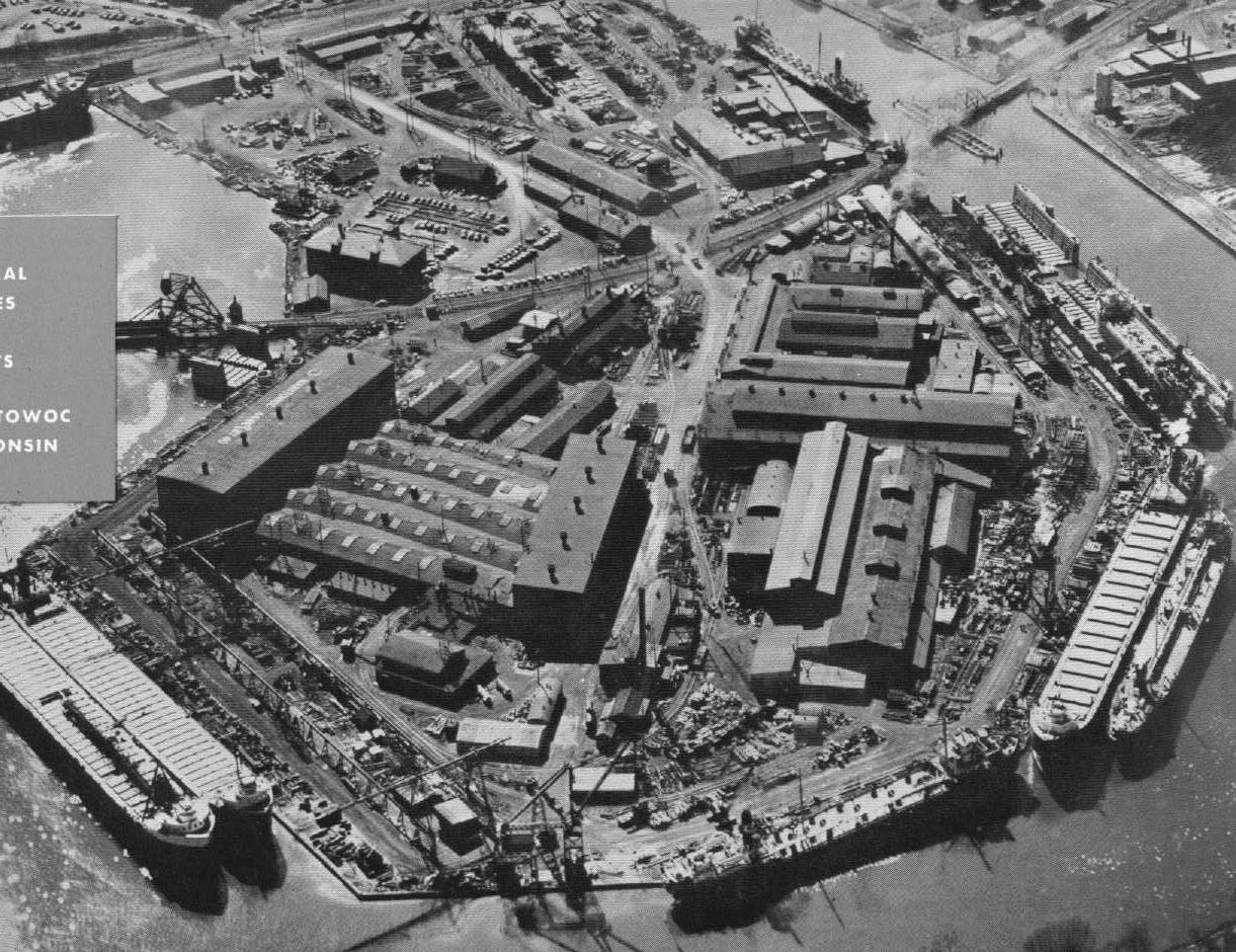
Manitowoc Shipbuilding/Fabricating/Manitowoc Company as seen from the air, from a promo brochure put out by Manitowoc Company ca. 1952. The Soo Line Manitowoc Line curves across the isthumus created by the meandering Manitowoc River. The Burger Bridge can be seen in the upper right, a portion of the Soo's "Jackknife Bridge" in the middle left. A very small portion of Manitowoc Portland Cement Co. can be seen near the Burger Bridge; their plant stretches along the river out-of-view across from the Manitowoc Shipbuilding plant to the right. A small portion of the C&NW Two Rivers branch can be seen in the upper left.
| ||||||||
| ||||||||
| Manitowoc-2.jpg (below, 1221 x 940, 1-man2) | ||||||||
|
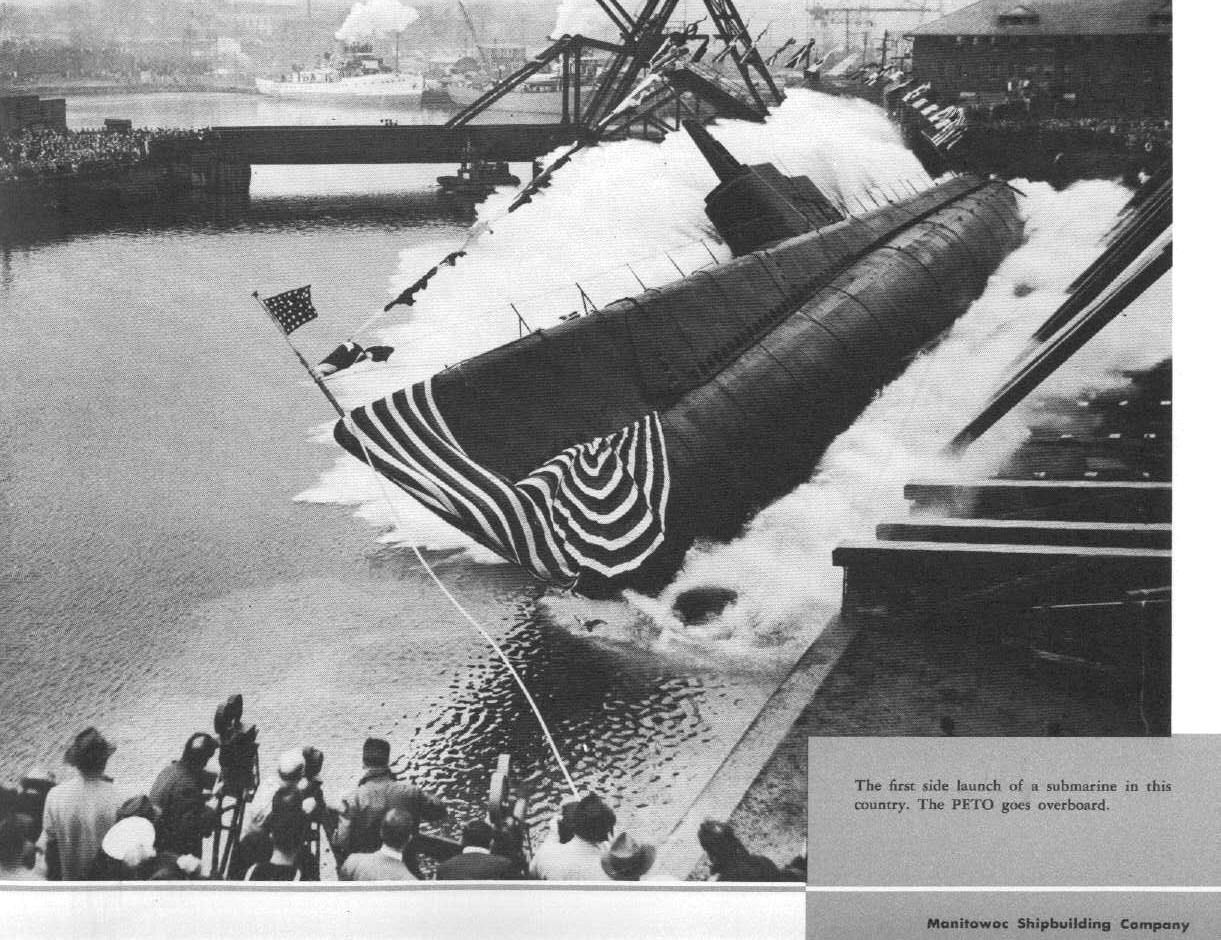
Manitowoc Shipbuilding Corp. launches a Submarine sideways into the Manitowoc River, ca. 1942. The Soo Line's "Jackknife" bascule bridge spans the river in the background, the Boat Yard is to the left. A companion photo to this one appears in the Time-Life WWII series of books, "THE WAR BELOW" which describes the US Navy's submarine warfare against the Japanese during WWII. This shot came out of a promotional brochure put out by Manitowoc Company around 1950-52. | ||||||||
| ||||||||
| Manitowoc Depot Looking East.jpg (below, 1102 x 644, 1-dep1) | ||||||||
|
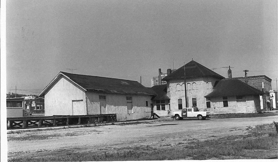
Photo by Ted Schnepf, and I think I still have his permission to post this on the Internet---if I don't, Ted'll whack me over the head with one of the larger books he sells at Train Shows. Soo's Manitowoc Depot around 1976-1977, my guess being before it was torn down. It has been repainted from when I remembered it from 1966. Back then it looked absolutely horrible due to the LACK of paint on it. Also, it had been wearing the simplified Soo Depot color scheme---everything a light cream color except for the bottom-most 1/4th of the building which was a red color. Ted is standing about mid-way between the Depot and the Ferry Slip. The Yard Tracks (tracks 6-10) are to his right. | ||||||||
| ||||||||
| Manitowoc Depot-Looking Northwest.jpg (below, 1102 x 516, 1-dep2) | ||||||||
|
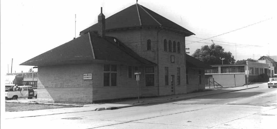
Ted Schnepf photo, used with permission (er, I think......). Soo's Manitowoc Depot looking from street-side. That's North 8th Street running past the building, one of the main thoroughfares running north-south through Manitowoc. Kersher Metal Services is the garage-like building to the right of the Depot; carferry slip, boat yard and Noerthern Elevator Co. are all out of sight to the left. A Soo covered hopper car pokes into the photo to the left of the depot, spotted at Northern Elevator. Originally, this building was built with double doors in a curved casing on both sides of that pagoda-like main section. This was remodelled sometime between 1930 and 1945. If you notice, the building is covered with Cedar Shake siding shingles, which explains why it had so little paint on it when I recall it from early childhood. | ||||||||
| ||||||||
| Manitowoc-Carferry Slip.jpg (below, 1101 x 692, 1-cfs) | ||||||||
|
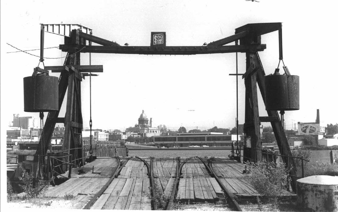
Ted Schnepf Photo, used with permission (er, I hope). The Soo's carferry slip in Manitowoc, Wis. Looking pretty weary by this time (ca. 197?). I note the Soo had put in some repairs to it---you'll notice the rocker arm on the upper left supporting the counterweight does not match the rocker arm on the right. The domed ediface in left center is the Manitowoc County Court House. Peeking out from under the left counterweight is a portion of the Rahr Malting/Anhaeuser-Busch Malting plant down on Lake Michigan's edge. The Manitowoc River itself heads off to the harbor to the left, about a mile away. To the right, the river bends around to surround three sides of the Manitowoc Shipbuilding Corp. The "Lower Ferry Yard" is behind Ted; the "Upper Ferry Yard" to the left. The Depot is to the left and slightly behind Ted's vantage point. Under the right counterweight you can see the Manitowoc Lake-to-Lake dairy plant, which marked the southern extent of the C&NW river track, which came off the Two Rivers Branch as it bent north-northwestwards. Originally, this track continued to the harbor mouth; C&NW stubbed it, I don't know when. I do not recall it crossing South 8th or South 10th streets when I lived in Manitowoc. | ||||||||
| ||||||||
| ||||||||

| ||||||||