The Marshfield & Texas Railroad
Marshfield, Wisconsin
SooLineHistory Group Index and Map 1 - The Story 2 - Pictures
3 - Pictures 4 - Pictures 5 - Pictures 6 - Pictures
7 - Pictures 8 - Pictures 9 - Pictures 10 - Pictures
11 - Pictures 12 - Pictures 13 - Pictures 14 - Pictures
15 - Pictures 16 - Pictures 17 - Pictures 18 - Pictures
19 - Pictures 20 - Pictures 21 - Pictures 22 - Pictures
23 - Pictures 24 - Speculations

Previous Page To see the pictures full-size, right-click and select "View Image."
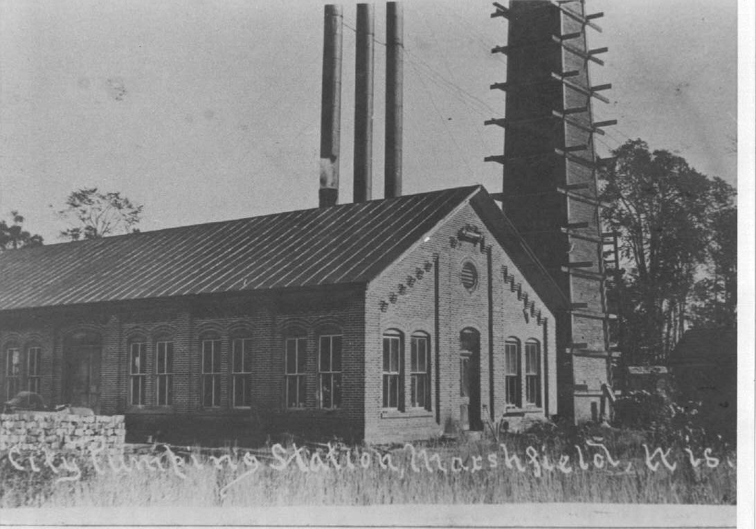
M&T-2 Power Plant 1899.jpg (below)
OK boys n' girlz, here are a few M&T shots from my collection of useless garbage. I'm going to send out a few snippets throughout the week, by no means am I going to try to send everything. It looks as though I will be able to perform a "Clinic" for the Winnebagoland NMRA Meet in Marshfield on October 30 concerning the M&T, so I'm busy scanning in what I have, correlating some of it with what Bruce sent me last week, and making a relatively coherent presentation via CD.

I'm NOT going to send everything. Ron Hanneman gets that dubious honor---he's burning the CD for me.

This first shot is from a Post Card view of the Power Plant ca. 1899-1900 shortly after Upham Mfg. built it. Keep this to compare later views on how this building morphed into something else!

Keith
M&T-3 Power Plant pre-WWI.jpg (below)
By 1920, the Municipal Power Plant looked like this. Note that the Spur into the Power Plant ends very short of the building. This is the way the track arrangement stayed until I really don't know when.

I'm also not very certain how much coal this facility was using at this time, either, nor how they unloaded it---much less how they got it IN the plant itself.

Keith
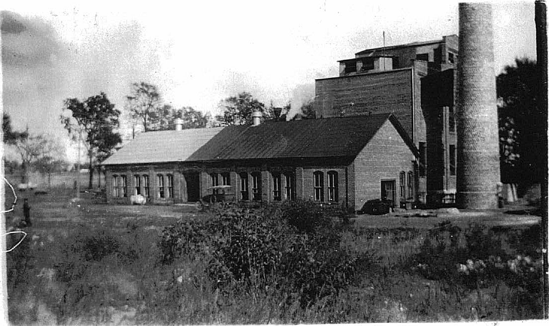
M&T-4 Power Plant 1920.jpg (below)
I'm not really certain what year the Upham Manufacturing Co. sold the Power Plant to the City of Marshfield. I've heard anywhere from 1912 to 1925. Here is a shot of the Plant about the mid-1920's. It is City owned by the time of this shot, and the City has added on to it and installed a bigger Turbine/Generator set. The M&T itself is on the opposite side of the building.
Keith
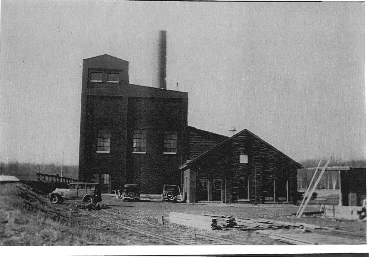
M&T-5 Power Plant Late 20's.jpg (below)
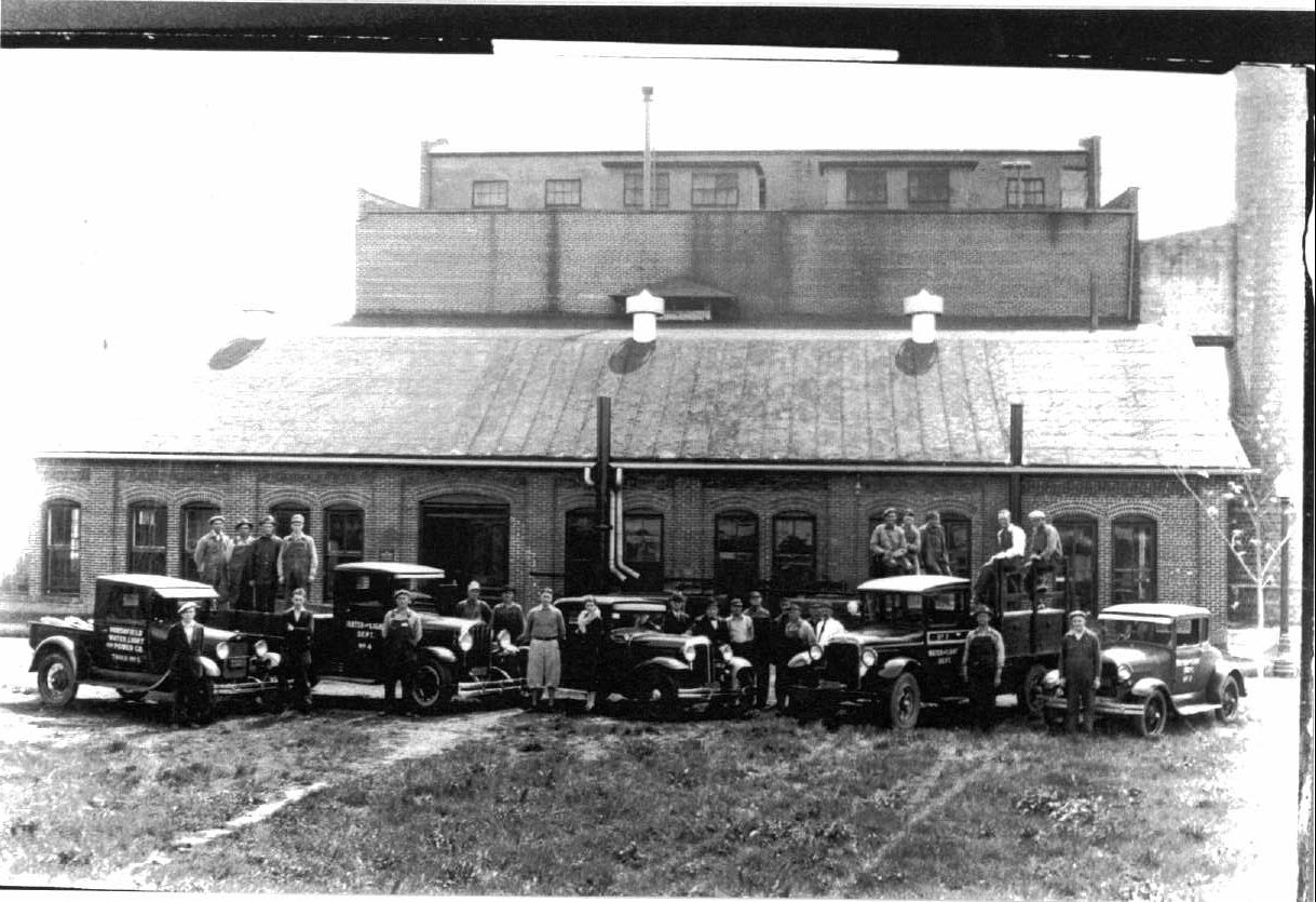
The Marshfield Electric & Water Department, including the sum total of their employees and line trucks, such as they were, ca. 192?

Here the Generator side of the plant has been extended once again, indicating the addition of another boiler/generator set to expand the capabilities of the power plant to match Marshfield's growing electrical needs.

Keith
M&T-6 Power Plant & Cooling Pond 1935.jpg (below)
By 1935, the Power Plant had morphed in to this. This shot looks southeast, more or less. This is the "Lower Cooling Pond" and behind the photographer is the area where the City put up their Zoo. It's not extant at the time of this photo yet.

Keith

M&T 7 Power Plant 1940.jpg (below)
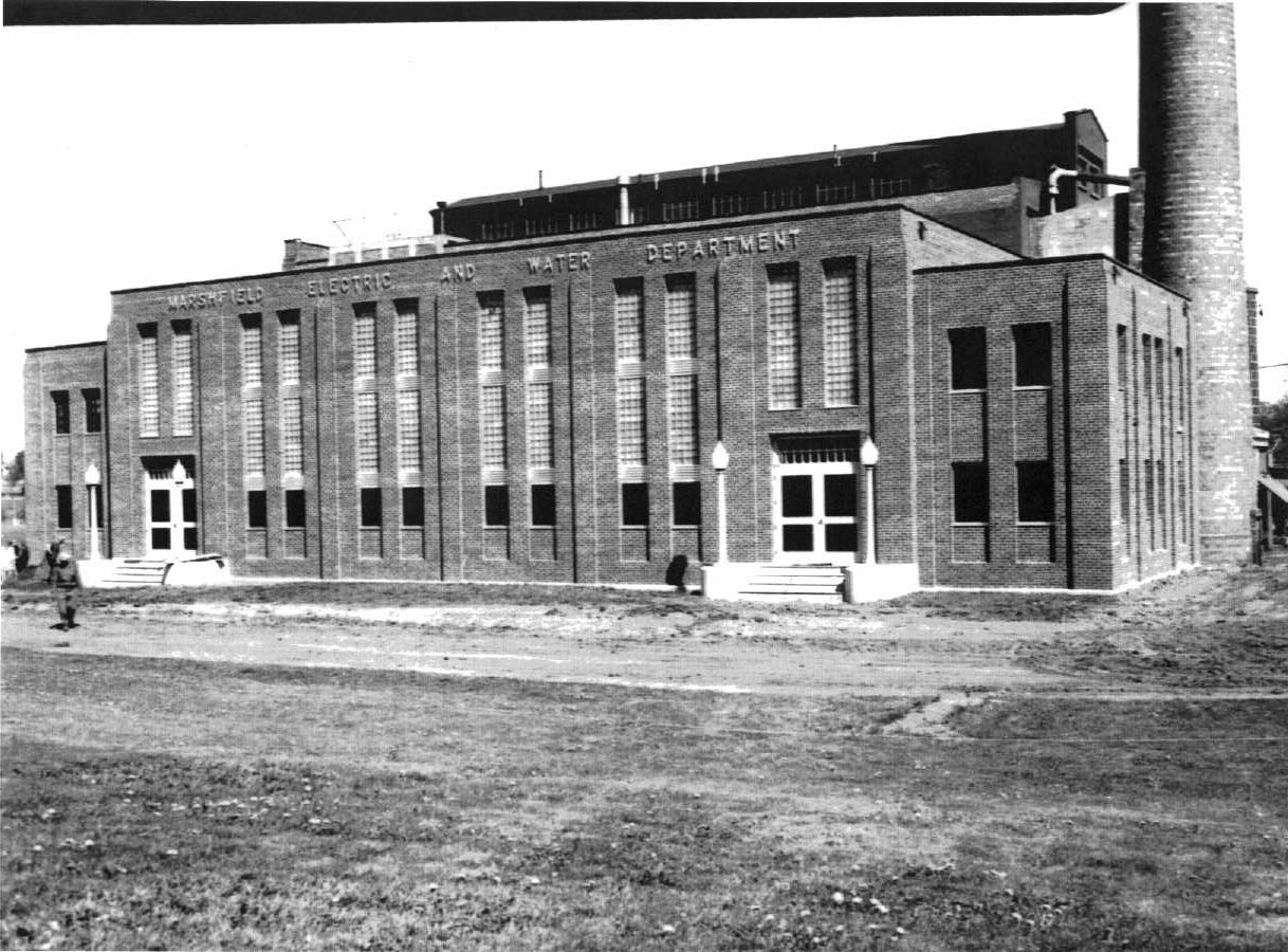
In 193? the City rebuilt the Control Room side of the Power Plant. This was the side where all the controls were; in the summer, when the employee would leave those double doors open, it was a sight to look inside at the giant panels that inhabited the interior with their collection of gauges, red, blue, yellow, green and orange lights, and differing sized control handles.

This part of the building's facade never changes once the City added it. It's roofline would change, but the exterior we see here did not, including the Aluminum lettering along the top edge of the building.

Keith
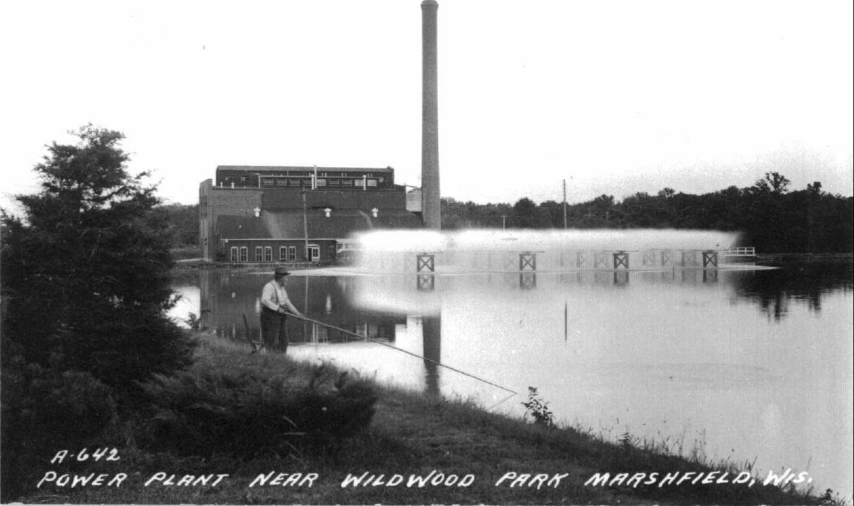
M&T-8 Power Plant & Cooling Pond 1940.jpg (below)
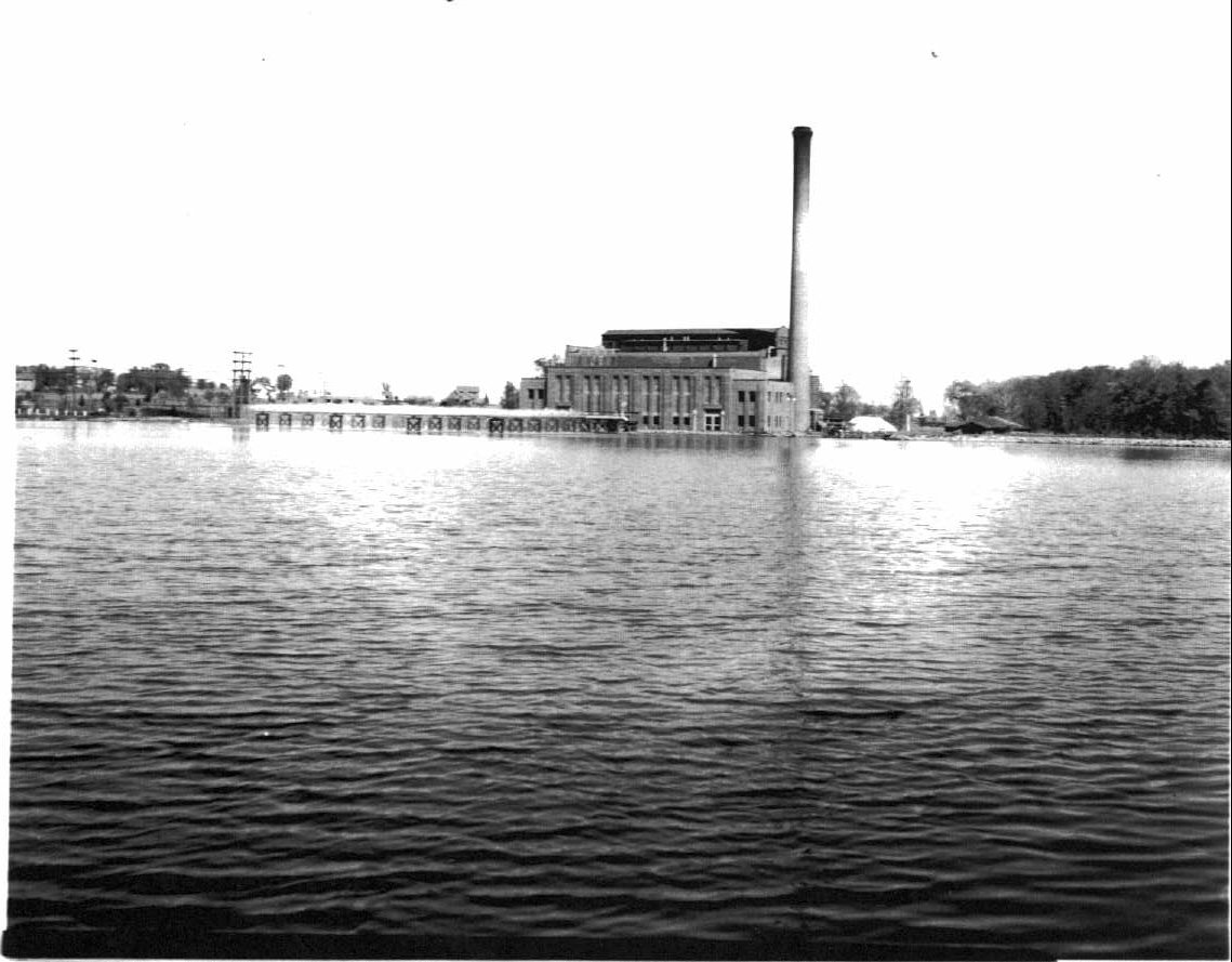
By the mid-1940's, the Power Plant looked like this. Note the original one-story building on this side has been replaced as the building and Marshfield's power needs continued to grow.

This is a postcard shot, and one that was used for a "Bit 'O Larceny" by the City for years. Had I not shown other views, you would be under the distinct impression this is a lake of decent proportions. No; it is the farthest western reach of the Lower Cooling Pond, photographed in such a way to make one think this is a pretty good-sized body of water. It's a possibility the photographer used a different lens to get this effect.

Keith
SooLineHistory Group Index and Map 1 - The Story 2 - Pictures
3 - Pictures 4 - Pictures 5 - Pictures 6 - Pictures
7 - Pictures 8 - Pictures 9 - Pictures 10 - Pictures
11 - Pictures 12 - Pictures 13 - Pictures 14 - Pictures
15 - Pictures 16 - Pictures 17 - Pictures 18 - Pictures
19 - Pictures 20 - Pictures 21 - Pictures 22 - Pictures
23 - Pictures 24 - Speculations

To see the pictures full-size, right-click and select "View Image." Next Page

The content of this page was created by Keith Meacham, and he retains the copyright.
Photographs are from the collection of Keith Meacham.
Ron Kohlin compiled Mr. Meacham's work for publication on the World Wide Web.
All rights reserved.
Created on September 29, 2004
Last changed on September 22, 2006
NOTE: In an effort to thwart the work of those automated "spiders" that roam
the internet harvesting e-mail addresses, to which their masters later direct mass
quantities of Spam, I have inserted the words "AT" and "DOT" in the link below.
When using the link below to contact the WebMaster, please replace those words
with the equivalent symbol, and remove any spaces, before sending the message.
It won't work unless you do. Hopefully your e-mail proggie will alert you.

Contact the WebMaster

Index to more Meacham drivel
Visit Ron's Rec Room